Cave Hill Conservation Campaign
Established in 1989
Awarded The Queen's Award for Voluntary Service in 2019.
History of the Cave Hill
History of the Cave Hill
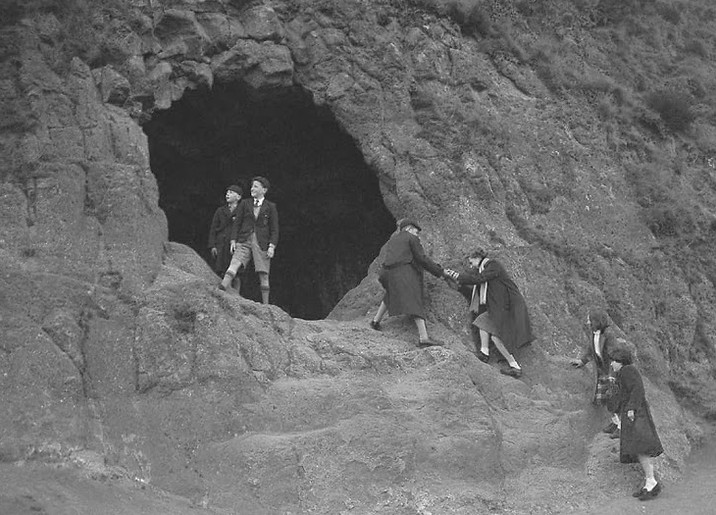

Cave Hill was formerly known as Ben Madigan, probably after a local chieftain who died in 855 AD. McArt's Fort is probably named after Brian McArt O'Neill, a prominent military leader in the area who took arms against the English in the Nine Years War (1594-1603). At the end of the war, the land around Cave Hill, along with a great deal more, was granted by King James 1. There are five caves (four visible from below) that are man-made, cut from the basalt. The lowest is accessible from the Sheep's Path. The caves were not permanently occupied, but may well have been used as temporary refuges.
The Cave Hill is the second most northerly of the Belfast Hills which forms the operational area of the Belfast Hills Partnership. The most northerly is Carnmoney Hill, and the other main hills, travelling southwards, are Squires Hill, Divis Mountain, Black Mountain, Collin and Slievenacloy. Most of this area is agricultural, with hill farming the main activity. The Belfast Hills range over four local authority areas, namely Antrim, Newtownabbey, Belfast and Lisburn. Only Cave Hill and Collin Glen have public park status, guaranteeing the public right of access. The significance of this was brought into stark prominence when the annual Belfast Hills Walk from Collin Glen to Cave Hill, scheduled for Sunday 30 May 1999, had to be greatly shortened at the last moment due to the refusal of one farmer to allow the walk to cross two metres of his land. The walk was confined to Collin and Divis.